The Community Forest of Hua Thung Village
Posted on behalf of Chattrabhorn Bua-in, Master’s student, Chiang Mai University
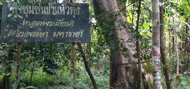
This is a sharing of my fieldwork experiences in Hua Thung village, Thailand. I would like to talk about the area of the community forest of Hua Thung village during quite a long interval of fieldwork. My fieldwork gave me the opportunity to view different seasonal conditions of the forests. The community forests in the village are a mixed deciduous type that cover an area of 8,000 square rais. The conservation began in 2007, and has been managed by Hua Thung village. In 2010 the Department of National Parks, Wildlife and Plant Conservation perceived the potential of this community to be able to become a pilot community of the REDD+ Project, and the cooperation has been well organized until the present time. The land area under the REDD+ Project has been separated into small plots of 1 rai with 15 plots altogether, scattered around the community based on the types of different forest features; that is, the healthiest forests, the medium healthy ones and the less healthy.
Below are some photographs of the different seasonal forest conditions.
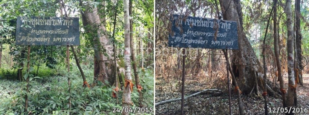
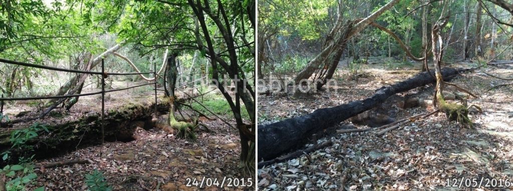
The photo on the left was taken on April 24, 2015 and the right was taken on May 12, 2016
Though both were taken in the summer period, they are obviously different. Generally, the forest used to be very fertile, but the dry condition as seen in the photo on the right is due to the big forest fire, which broke out after many years without any. A local person said, “Since I was born, this is the first time I’ve seen such a forest fire.” The fire took place on April 13, 2016 which was on the traditional New Year’s day for the people in the north. As such, most of the local people were not at home. That made it very difficult to extinguish the fire. However, the fire did not spread deeply into the forest.
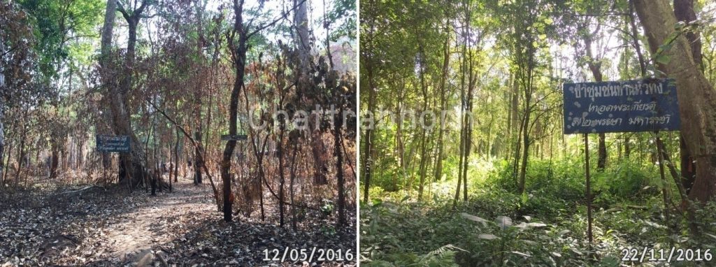
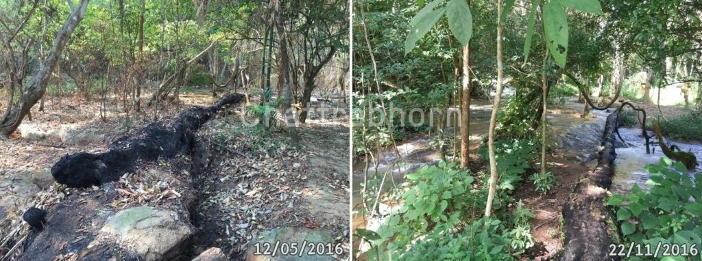
The photo on the left was taken on May 12, 2016 and the right was taken on November 22, 2016
Recently, I had a chance to go back to the village where I found that the community forest ruined by the fire of the previous April has revived and become richly healthy. Surprisingly, there was an overwhelming stream of water coming out from the watershed. That was the first time of many times of visiting the village that I saw the stream which the villagers called “naam oork hoo” which can be translated word for word as: water-go out-hole. The expression is in the local language and refers to the stream that flows out from the hole in the earth from the watershed deep in the ground. In June of every year the local people organize a ceremony to pledge for the seasonal rain. The ceremony is called the “liang-phii-khun-naam” whose word for word meaning is: treat-ghost-noble-water. That is to worship all the angels that protect the forests, and after the ceremony there will be water flowing out into the community to sustain their agriculture.
When the community has fertile forests and plenty of water, it is definitely related to the season and their beliefs. However, what I have witnessed was the strong cooperation among the people there and their widely open minds to accept new methods such as REDD+ which has made the community gain enough money to take good care of their forests. Although the villagers did not have a chance to fully participate in the project work due to the complicated techniques and methods of this project, the government officials realized the relationship between the people and the forests, so the project was adjusted to be appropriate to the context of their community.

This is very interesting. One conclusion might that while fire may not be good for REDD+, fire might be good for the fertility of the forest. It also illustrates just how dynamic forest-people relations can be. Love the photos and how they show the changes in the forest over time.