Payment for Ecosystem Services (PES) in Upper Thung Jaw Watershed, Hua Lao Village, Thailand
An Overview of the Payment for Ecosystem Services (PES) project in Upper Thung Jaw Watershed, Hua Lao Village, Pa Pae Subdistrict, Mae Taeng District, Chiang Mai Province, Thailand
Posted on behalf of Rapipun Maoyot, Chiang Mai University
Using information gathered from the Payment for Ecosystem Services (PES) study in Hua Lao Village in which Karen people live, historical backgrounds of the village, general information and the reasons why the PES project has been implemented will be elaborated.
Hua Lao Village is one of eight zones of Mae Lao Village, Moo 5, Pa Pae Subdistrict, Mae Taeng District, Chiang Mai Province. The geographical upland Hua Lao Village is a part of Mae Lao Village.
The Hua Lao is located in Thung Jaw water source. Sgaw Karen is the majority people in the area, called in other names: Yang Kao, Yang Kalur, Yang Pa, or Yang Piang. They basically call themselves “Pakayor” or “Pakakeryor” which means human, a group of natural forestry conservation succeeded for a long period of time. There are 68 households in Hua Lao Village with 10,222 rais 1 ngan, 44 square wah. Forest land, living forest, and conservation area are 88 percentage of the whole area.
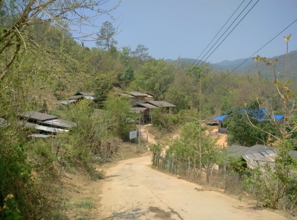
Photo: Hua Lao village
Their main occupation is farming and the main commercial plants are rice, tea, food wrapped in leaves, banana and pomelo. They also raise pig, chicken and buffalo for sale and household consumption. Moreover, the villagers work off-farm such as building contractor, garden employee and collecting forest products. They also grow rice mainly for consumption, and extra for sale.
The agricultural system is shifting cultivation and rice terrace. They do farming in particular pieces of land and move to other pieces of land in next seasons while leaving the previous land to be reclaimed for about 3-4 years. The upland rice terrace is built on a sloped plane, resembling steps and receiving the weir in the village.
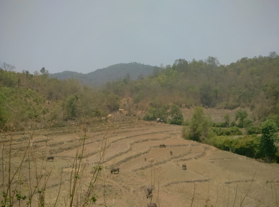
Photo: Rice terrace at Hua Lao village
In terms of history, the village is located in the Lua community, as evidenced by the abandoned temple built from bricks; pool and settlement trace. The Pakayor came after and took place of the Lua. The tribe leader was called Hi Kho and succeeded the position through kinship. For instance, after the Hi Kho father passed away, the son would take his father’s role. But if he would not, the closest kin would be appointed leader. The name of the village and river is derived from “Dok Lao” plant which was found in the area.
In the evolution of forestry resource conservation, in the initial stage the villagers had not taken much care of the forest or done as much as they could. They also did shifting cultivation together with making line of fire around the forest lands and farming lands. The line is important in preventing the village farming lands from the fire because its location is exposed to fire. The line of fire is a local wisdom of upland people to adapt to the risks and deal with fire, and for resource conservation. In case of natural losses from fire, villagers will be unable to access the forest products for cooking and earning money. Therefore, forest conservation with line of fire becomes important for livelihood and community.
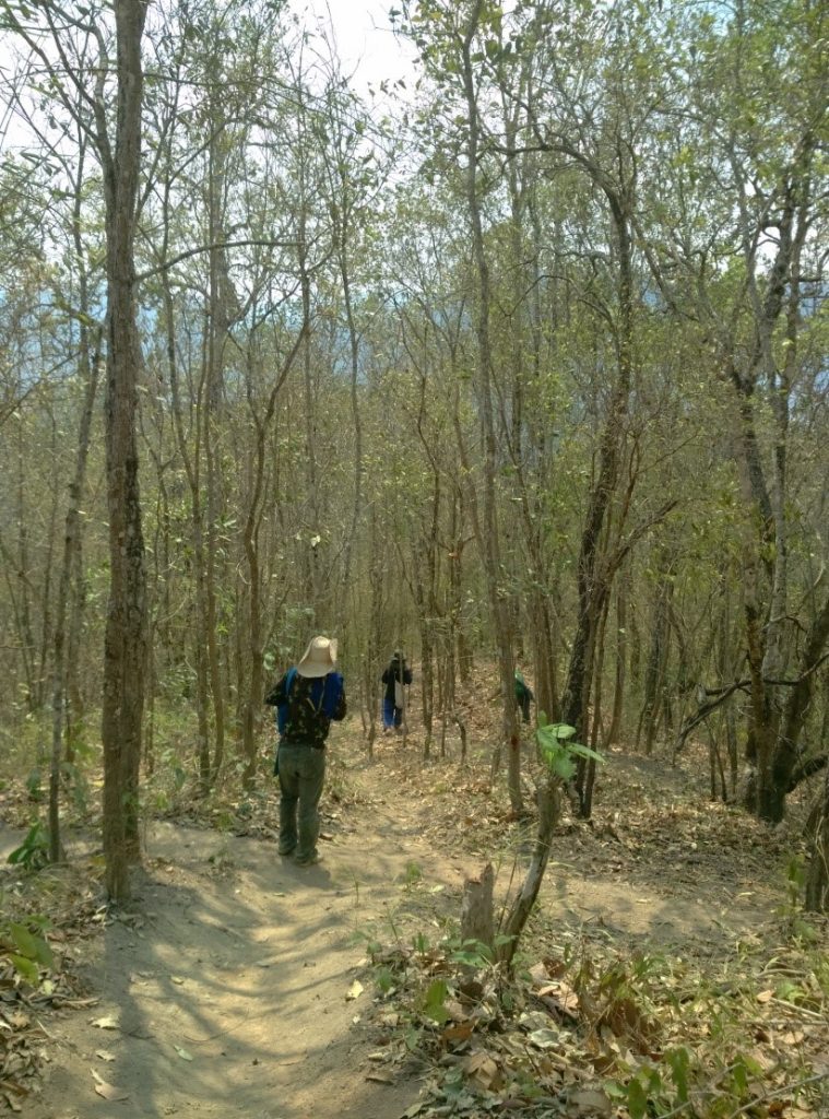
Photo: Firebreaks at Hua Lao village
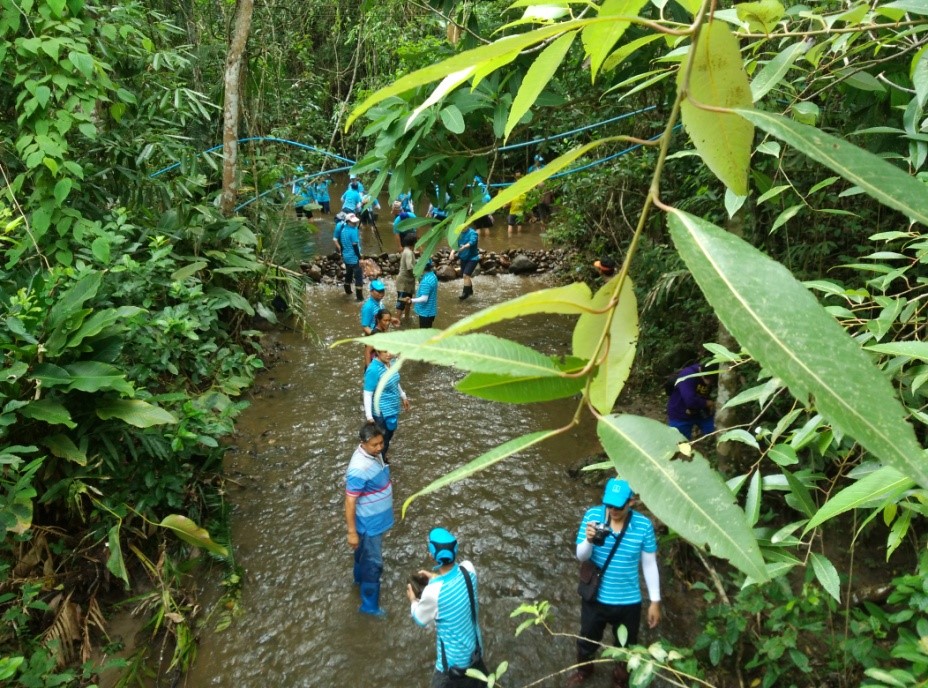
Photo: Building the wet firebreak at Hua Lao village
Thung Jaw Upstream Management Unit offered significant support on fire control and resource conservation from 1989 until 2003. In 1993, the villagers contacted the government agency because outsiders encroached on the conserved forest areas for farming. In this case, the piece of land was closed to the Lee Saw’s village from which the villagers might be suspected to have originated. However the Karen attempted to address the problem by making agreement with the Lee Saw and even expelling them from the forest. In 1993 the conflict was getting worse, the outsiders were then invited through a mediator to enter into an agreement.
In 1999, a forest officer put pressure on the villagers on land zoning control in terms of farming, housing, and forest. Meanwhile, the villagers had finished the line of fire and conservation zone, shown by “the acknowledgement of land ownership in forest lands” according to cabinet resolution on May 11, 1999. It was said that the villagers are allowed to do farming on their existing lands but have no rights to expand. In fact, nobody owned their lands and that made them feel insure in their land rights. Some villager was arrested despite owning the acknowledgement.
In 2009, Inter Mountain Peoples’ Education and Culture in Thailand Association (IMPACT) had implemented zoning and mapping. Forest types were divided by exploring the village boundary. They also made 36 kilometers of fire control around the village. Co-management Learning Network (CMLN) was also working on co-management, reforestation and sustainable planning of how humans adapt to live with forest by means of separating forest from farming zone. They marked the boundary and made a farming land map.
In 2011, Payment for Ecosystem Services (PES) was initiated in Thailand by Biodiversity-Based Economy Development Office (BEDO: Public Organization) established from Royal Decree since 2007.
BEDO works as a middleman to make agreement between PES and Hua Lao Villagers. Although PES is not controversial in Thailand yet, it is taken into account for BEDO objectives coincided with national strategies on building incentives for entrepreneurs and target sites.
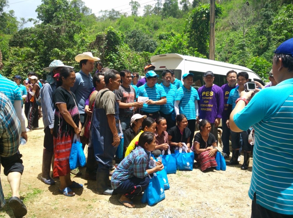
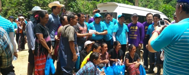
Photo: The activity that Provincial waterworks authority Regional Office 9 and BEDO donated to the villagers
BEDO launched the PES project in 3 pilot projects in Thailand:
1) Thung Jaw water source, Pa Pae subdistrict, Mae Taeng District, Chiang Mai Province.
2) Klongprasong Subdistrict, Muang District, Krabi Province
3) Chumkho Subdistrict, Pa Thiu District, Chumphon Province
Hua Lao PES project in the Thung Jaw water source sold the ecosystem service to Provincial Waterworks Authority Regional Office 9, Chiang Mai. The provider of the services is Pakakeryor, Hua Lao Village. The ecosystem service (ES) is underground water and fertile forest.
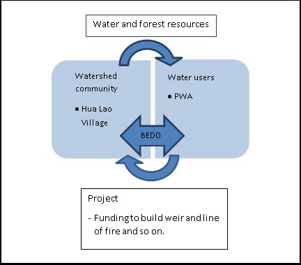
Figure 1: Interaction between Hua Lao Villagers who were a provider of the ecosystem, water supply buyer and BEDO which is a mediator
There are three factors why Hua Lao Village is selected as a study site in terms of operating the PES project herewith.
1) First factor is ecosystem service in water source
2) Second factor is a local environment conservative group taking a good care of the ecosystem. Forest conservation is important to the Pakakeryor livelihood. Water is used for daily activities; consumption and farming particularly rice paddy field and orchard which required a large amount of water. The water source management activity is also held by Hua Lao villagers working with the local group and active organizations but they still lack capacities and funds.
Table 1: Summary of the ecosystem service in Hua Lao Village, Pa Pae Subdistrict, Mae Taeng District, Chiang Mai
| Ecosystem Services
(Water) |
Service Providers or Sellers | Buyers | Tools
|
Impacts on forest | Expense |
| Increasing Underground water as raw water used for water supply in Chiang Mai. | Hua Lao villagers, Pa Pae Subdistrict, Mae Taeng District, Chiang Mai | Provincial waterworks authority Regional Office 9
|
Payment by funding on building weirs and making the line of fire | Increasing humidity of the forest | Supporting money to build 6 weirs in 2014. Pay 20,000 baht in 2015. Pay 20,000 baht in 2016 |